Australia/Oceania Maps
australia/oceania maps — pre-owned
Browse 39 australia/oceania maps — pre-owned on eBay — listings updated every few minutes. All items are pre-owned and sold by eBay sellers directly.

Australia Map No. 18 Reproduction Printed In 2014 27.5” X 19.5” Poster
Like new condition. Inc. - printed in Korea on Italian paper. 27.5“ x 19.5“.

Vintage 1960s Pull Down School Map Of Southeast Asia And Australia
vintage 1960s AJ nystrom pull down school map of Southeast Asia and Australia with the clear map for marking nap numbers pr83 -10 and pr83 -1. some water damage on the bottom right corner but otherwise in good shape for its age.

New Caledonia & New Hebrides - 1942 Vintage WW2 Serial Map Service Map
A very attractive map, originally extracted from an original Serial Map Service Subscription publication. see photo.

Disposition of Australian Forces in July 1940 - 1967 Vintage WW2 Map
Slight light wavyness to sheet with age and a slight light crease to bottom right corner.

1881 Antique New Zealand Map Encyclopaedia Britannica Johnston Plate XIV
Encyclopaedia Britannica, Ninth Edition. Encyclopaedia Britannica, Ninth Edition , published in 1881. The plate shows both North Island and South Island with towns, coastlines, rivers, county references, and period geographic detail, along with a separateGeological Sketch Map inset at upper left.
You save $1.90

Pacific Ocean depths & telegraph cables. Marquesas Tahiti Tonga. TIMES 1895 map
Antique colour atlas map, 1895. DATE PRINTED: 1895. 'Pacific Ocean'. CAPTION BELOW PICTURE: 'Pacific Ocean '. AUTHENTICITY: This is an authentic historic print, published at the date stated above. It is not a modern copy.

FRENCH POLYNESIA. Polynésie française. Tahiti Moorea Nuka Hiva Oa 1931 old map
Inset: Île Nouka-Hiva; Île Hiva-Oa; Île Clipperton; Îles sous le vent; Tahiti et Moorea; Île Toubouai; Île Rapa; Rangiroa & Tikahaou; Fakarava; Îles Gambier'. DATE PRINTED: 1931. CONDITION: Good; suitable for framing.

Océanique Partie de la Nle Zélande 60 New Zealand South Is VANDERMAELEN 1827 map
Lithography by Henri Ode. [This landmark atlas is remarkable as the first atlas to have been produced using the then new printing process of lithography. Océanique - Partie de la Nouvelle Zélande [Note sur la Nouvelle-Zélande; Suite de la Note sur la Nouvelle-Zélande] - No. 60. ].

MICRONESIA. 'Habitans des Isles Larrons'. People of Marianas. MALLET 1683 map
'Habitans des Isles des Larrons' (De L'Asie). TITLE OF THE MAP: 'Habitans des Isles des Larrons'. Original 17th century copperplate map, 1683. DATE PRINTED: 1683. CONDITION: Good; suitable for framing.

Océanique Partie de la Nle Zélande 59 New Zealand North Is VANDERMAELEN 1827 map
Lithography by Henri Ode. [This landmark atlas is remarkable as the first atlas to have been produced using the then new printing process of lithography. Océanique - Partie de la Nouvelle Zélande [Note sur la Nouvelle-Zélande] - No. 59. ].

MICRONESIA. 'Isles des Larrons. Marianas &c. Siapan Guam Palau. MALLET 1683 map
'Isles des Larrons' (De L'Asie). TITLE OF THE MAP: 'Isles des Larrons'. Original 17th century copperplate map, 1683. DATE PRINTED: 1683. Shows the Mariana islands including Sepan (Saipan), Gan (Guam) & Pulo (Palau).

AUSTRALASIA. January & July temperature; Annual rainfall. BARTHOLOMEW 1952 map
Scale 1:25,000,000, 1952. DATE PRINTED: 1952. CONDITION: Good; suitable for framing. The map you will receive is in good condition but there may be minor variations in the condition from that shown in the image.

Calm during the hurricane at Reunion, Feb 17, 1761. Réunion. Sketch map 1886
'Calm during the hurricane at Reunion, Feb 17, 1761'. TITLE OF MAP: 'Calm during the hurricane at Reunion, Feb 17, 1761'. Antique engraved sketch map, 1886. DATE PRINTED: 1886. TYPE: Antique engraved sketch map.

Caroline and Marianas Islands - 1944 Vintage WW2 Serial Map Service Map
A very attractive map, originally extracted from an original Serial Map Service Subscription publication. see photo. Two binding holes to one edge.

ORIGINAL 1855 COLTON'S HAND COLORED MAP OF AUSTRALIA
Publisher: J. H. Colton & Co. Date: 1855. Antique hand colored map is toned but clean and in very good condition. 18.5" x 16".

c.1956 Davis Pictorial Map Island of Guam - **ORIGINAL
Originally folded. Produced for Catalina Studios. Size: 17 7/8" x 23 5/8" in. Not to be confused with another later version of this map by the South Seas Trading Co.1966.

Japan from Alaska—Persuasive map—World War 2—Richard Edes Harrison—Fortune 1944
PROVENANCE: "Look at the World—A Fortune Atlas for World Strategy", by Richard Edes Harrison, text by the editors of Fortune. New York: Alfred A. Knopf. Harrison's "Japan from Alaska" argues that the northern Pacific was not a remote flank but a direct approach to Japan.

Geological Sketch Map of Queensland showing the mineral localities—Dunstan 1908
Drawn on stone by H. W. Fox. CAPTION BELOW PICTURE: 'Geological Sketch Map of Queensland showing the mineral localities'. PROVENANCE: Geological Survey of Queensland. Large folding geological map, dissected and laid down onto linen, 1908.

Yap. Micronesia 1885 old antique vintage map plan chart
TITLE OF MAP: 'Yap'. Antique wood-engraved map. Scale 1:350,000, 1885. DATE PRINTED: 1885. CONDITION: Good; suitable for framing. VERSO: There are images and/or text printed on the reverse side of the picture.

OCEANIE. Oceania. Australia New Zealand. Antique map/carte. LEVASSEUR 1856
CAPTION BELOW PICTURE: 'Oceanie'. Wide margins, 1856. DATE PRINTED: 1856. Wide margins. CONDITION: Good; suitable for framing. The map you will receive is in good condition but there may be minor variations in the condition from that shown in the image.

The Commonwealth of Australia—Persuasive map—Richard Edes Harrison 1950
Australia is almost U.S.-sized, yet dry, thinly peopled and vulnerable; its interior lacks rivers and rainfall, while its fertile margins, coal, steel and minerals suggest latent strength. 'The Commonwealth of Australia'.

A Map of New Philippine Islands—Palau—Carolines—Micronesia—Andrew Johnston 1721
Antique uncoloured copper-engraved map, 1721. DATE PRINTED: 1721. Abridged and dispos’d under General Heads. Containing Part III. The Physiological Papers [and] Part IV. The Philological Papers. Edited by Benjamin Motte.

WESTERN AUSTRALIA Original Antique map 1927
Original antique map of "Western Australia" published by W & R Chambers, 1927. This is NOT a reproduction.

Olympic Games Melbourne 22 Nov–8 Dec 1956. Commemorative silk fabric map 1956
DATE PRINTED: 1956.

COLONIAL NEW GUINEA. Kaiser Wilhelm Land. British & Dutch New Guinea 1895 map
Antique colour map, 1895. DATE PRINTED: 1895. 'New Guinea'. TITLE OF MAP: 'New Guinea'. TYPE: Antique colour map. VERSO: There are images and/or text printed on the reverse side of the picture. CONDITION: Good; suitable for framing.

COLONIAL NEW GUINEA. Kaiser Wilhelm Land. British & Dutch New Guinea 1910 map
'New Guinea'. TITLE OF MAP: 'New Guinea'. Colour antique map, 1910. DATE PRINTED: 1910. TYPE: Colour antique map. VERSO: There are images and/or text printed on the reverse side of the picture. CONDITION: Good; suitable for framing.
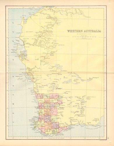
WESTERN AUSTRALIA. State map showing only 26 counties. Perth 1876 old
Antique colour map, 1876. DATE PRINTED: 1876. CONDITION: Good; suitable for framing. The map you will receive is in good condition but there may be minor variations in the condition from that shown in the image.

Hawaii Cook Fiki Samoa Tonga Tahiti New Hebrides/Caledonia islands 1922 map
'Islands of Oceania. New Hebrides. Hawaiian Islands. Cook Islands. Samoan Is. Society Is. New Caledonia and Loyalty Islands. Fiji Islands.

Isles de la Société. Society Islands. Huaheine Raiatea Polynesia. BONNE 1788 map
Antique 18th century copperplate map, 1788. DATE PRINTED: 1788. DEUTSCHLAND: Alte Lankarten und Stadt ansichten. ITALIA: Stampe e Mappe antiche. ESPAÑA: Mapas antiquos y impresiones antiguas. Force Majeure.

Bering Sea. Pacific Ocean. Sketch map 1885 old antique vintage plan chart
'Bering Sea'. TITLE OF MAP: 'Bering Sea'. Antique engraved sketch map, 1885. DATE PRINTED: 1885. TYPE: Antique engraved sketch map. CONDITION: Good; suitable for framing. VERSO: There are images and/or text printed on the reverse side of the picture.

VAN DIEMEN'S ISLAND OR TASMANIA. Shows extinct Thylacine. RAPKIN/TALLIS 1851 map
Antique engraved map by J Rapkin, published by John Tallis. Original outline hand colour, decorative border, and attractive inset vignette views, 1851. Published by John Tallis & Co. TYPE: Antique engraved map by J Rapkin, published by John Tallis.

Battle of Coronel, November 1st 1914. First World War. 1920 old antique map
Coronel November 1st 1914 [Battle of Coronel]. CAPTION BELOW PICTURE: 'Coronel November 1st 1914 [Battle of Coronel]'. Naval Operations Vol I To the Battle of the Falklands December 1914". By Sir Julian S. Corbett.

WESTERN AUSTRALIA. Inset plan of Perth. HARMSWORTH 1920 old antique map chart
PROVENANCE: "Harmsworth's New Atlas". 'Western Australia; Inset map of Perth'. CAPTION BELOW PICTURE: 'Western Australia; Inset map of Perth'. Scale 1:6,200,000, 1920. DATE PRINTED: 1920. CONDITION: Good; suitable for framing.

Australia & New Zealand. Victoria & New South Wales. FULLARTON c1863 old map
Large hand coloured antique atlas map, c1863. PROVENANCE: "The Royal Illustrated Atlas of Modern Geography", with an introductory notice by Dr. N. Shaw., Secretary to the Royal Geographical Society. 'Australia and New Zealand'.

Daily Express War Map of the Pacific showing Japanese occupation countries 1941
A purple military-occupation overprint shows Japan’s advance before Pearl Harbor: Manchukuo/Manchuria; occupied Inner Mongolian and north China zones; eastern/coastal China around Peking/Tientsin, Shanghai-Nanking-Hangchow and Canton; Hainan; and French Indo-China.

Sydney in 1802. Australia 1885 old antique vintage map plan chart
'Sydney in 1802'. TITLE OF MAP: 'Sydney in 1802'. Antique wood-engraved map. Scale 1:33,000, 1885. DATE PRINTED: 1885. CONDITION: Good; suitable for framing. VERSO: There are images and/or text printed on the reverse side of the picture.

1904 Antique Map AUSTRALIA New Zealand Philippines Pacific Islands Original
Australia & New Zealand: Detailed mapping of the Australian states (Western Australia, Queensland, New South Wales, etc.) and New Zealand, including a "Comparative Area" inset showing the scale of Pennsylvania.

Australia Occupation of German New Guinea 1914. First World War. 1920 old map
Naval Operations Vol I To the Battle of the Falklands December 1914". By Sir Julian S. Corbett. Antique military history map, 1920. DATE PRINTED: 1920. CONDITION: Good; suitable for framing. AUTHENTICITY: This is an authentic historic print, published at the date stated above.

New Guinea and the Solomons - 1942 Vintage WW2 Serial Map Service Map
A very attractive map, originally extracted from an original Serial Map Service Subscription publication. see photo. Corner fold to bottom right corner.