Maps & Atlases
maps & atlases — pre-owned
Browse 40,832 maps & atlases — pre-owned on eBay — listings updated every few minutes. All items are pre-owned and sold by eBay sellers directly.

3x Ordnance Survey Maps Explorer 1xPeaks OL24. 2x North Coast Cornwall 104/106
OL24 region - White Peaks. 104 Redruth.

5 X OS 1 :25000 MAPS EXPLORER 373,375,453,454 MULL AND UIST + PATHFINDER EIGG
AND THE PATHFINDER SERIES MAP EIGG, MUCK & RHUM SOUTH. 453 BENBECULA & SOUTH UIST. 454 NORTH UIST AND BERNERAY. 373 IONA, STAFFA & ROSS OF MULL.

National Geographic Satellite Atlas of the World Hardcover Illustrated Maps
Explore the Earth from space with this beautifully illustrated reference from the National Geographic Society.

Bartholomews Cloth Map Keswick Grasmere 1900's
I THINK THIS FROM 1900'S.

OS Landranger Map 151 Stratford-upon-Avon (2023) 1:50000
This is OS Landranger map 151 Stratford-upon-Avon, including Warwick & Banbury, published 2023. Map in photos is the actual map you will receive.

Alpenvereinskarte 31/1 - Stubai Alpen - HochStubai 1:25000 Hiking map
The Alpenvereinskarte 31/1 - Stubai Alpen - Hochstubai 1:25000 hiking map, published by Alpenvereinskarten in 2016, is a detailed and informative guide for hikers in Austria. This German-language map, with a scale of 1:25,000, features the Stubai Alps and Sellrain region, providing a comprehensive overview of the area's hiking trails and landmarks. The folded map design makes it easy to carry and reference while out on the trails, making it a valuable resource for adventurers looking to explore the beautiful European outdoors.

National Geographic Concise At - ACCEPTABLE
Notes: Item in acceptable condition!

The Penguin Historical Atlas of the Vikings (Hist Atlas) - Paperback - GOOD
Notes: Item in good condition.

Glamping with MaryJane: Glamour + Camping - Hardcover - GOOD
Notes: Item in good condition.
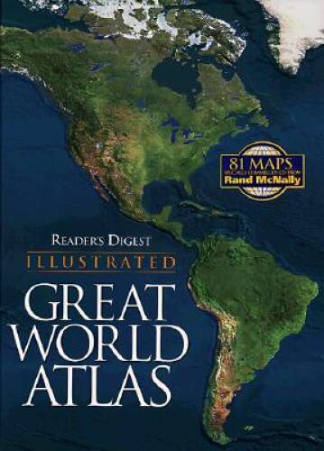
Readers Digest Illustrated Great World Atlas - Hardcover - GOOD
Notes: Item in good condition.
You save $0.67

OS Landranger Map 162 Gloucester & Forest of Dean (2019) 1:50000
This is OS Landranger map 162 Gloucester & Forest of Dean, published 2019. Map in photos is the actual map you will receive.

Cockpit Confidential: Everythi - GOOD

OS Explorer Map OL23 Cadair Idris & Llyn Tegid (2019) 1:25000 w/Digital Code
This is OS Explorer map OL23 Cadair Idris & Llyn Tegid, Showing parts of the Snowdonia national Park, published 2019.

The Atlas of Ancient Rome by Andrea Carandini, Hardcover, Two-Volume Set
The Atlas of Ancient Rome by Andrea Carandini, Hardcover, Two-Volume Set

The World Book Atlas 1966 Field Enterprises Hardcover Illustrated Geography
The World Book Atlas 1966 Field Enterprises Hardcover Illustrated Geography is a comprehensive book that provides detailed information about the geography of the world. Published by Field Enterprises Educational Corporation, the atlas features illustrations and maps to help readers understand various regions, countries, and cities. With a focus on geography and geosciences, this book is a valuable resource for students and educators alike. The atlas covers topics ranging from physical geography to cultural aspects of different regions, making it a valuable addition to any collection of textbooks and educational materials.

National Geographic Atlas of the World Revised Third Edition 1970 Hardcover Sli…
The National Geographic Atlas of the World Revised Third Edition 1970 Hardcover is a comprehensive and visually stunning book that provides detailed maps and illustrations of the world. Published by the National Geographic Society, this atlas features contributions from renowned authors such as Melvin M. Payne, Melville Bell Grosvenor, Frederick G. Vosburgh, and Wellman Chamberlin. With its revised edition status, this book offers updated information and insights into geography and geosciences, making it a valuable resource for students, educators, and anyone interested in exploring the world through maps and illustrations. This thing is massive!

OS Tour Map The Cotswolds & Gloucestershire (2020) 1:100000
This is OS Tour map The Cotswolds & Gloucestershire, published 2020. OS Landranger Map 194 Dorchester & Weymouth (2016) 1:50000. Map in photos is the actual map you will receive.

The Address Book: What Street Addresses Reveal About Identity, Race, - VERY GOOD
Notes: Item in very good condition!
You save $0.23

Glamping with MaryJane: Glamour + Camping - Hardcover - VERY GOOD
Notes: Item in very good condition!

OS Landranger Map 160 Brecon Beacons Bannau Brycheiniog Ordnance Survey
OS Landranger Map 160 – Brecon Beacons / Bannau Brycheiniog. Discover the breathtaking scenery of theBrecon Beacons (Bannau Brycheiniog) with this genuineOrdnance Survey Landranger Map 160. ✅ Covers Brecon Beacons / Bannau Brycheiniog.

Vintage 1924 SOIL SURVEY OF WORCESTER COUNTY MARYLAND US DEPT OF AGRICULTURE
I do my best to describe and photograph any flaws. Slight wear or signs of use may be present.

OS Landranger Map 75 Berwick-upon-Tweed Holy Island Wooler Ordnance Survey
OS Landranger Map 75 – Berwick-upon-Tweed, Holy Island & Wooler. ✅ Covers Berwick-upon-Tweed, Holy Island & Wooler. Explore one of the UK's most stunning coastal and countryside regions with this genuineOrdnance Survey Landranger Map 75.

The Worst Case Scenario Survival Handbook: Travel - Paperback - GOOD
Notes: Item in good condition.

Delorme Arizona Atlas & Gazetteer by Rand McNally: Used
Good Used Paperback
You save $2.29

Charles F. Pfeiffer Lot of 2 - Baker's Bible Atlas & The Biblical World

The Cartographic Satellite Atl - VERY GOOD
Notes: Item in very good condition!

National Geographic Atlas of the World, Eighth Edition - Hardcover - GOOD
Notes: Item in good condition.
You save $5.92

Alaska Atlas & Gazetteer - Perfect Paperback By DeLorme - GOOD
Notes: Item in good condition.
You save $0.25

Vintage The Times Atlas of the World Comprehensive Edition Book 1983
If there are any major flaws, they have been noted.

Vintage UK Maps Joblot
Vintage UK Maps Joblot

Rand McNally Easy to Fold United States Laminated Map 13 States
The product is a set of 13 Rand McNally Easy Fold Laminated Maps covering southeastern states. These state maps are designed for easy folding and durability thanks to the laminated feature. Published by Rand McNally, a reputable source, these maps provide detailed information of the states in a compact and convenient format.

Star Trek Stellar Cartography Starfleet Reference Library Maps Complete Set
The product is a complete set of Star Trek Stellar Cartography maps from the Star Trek Universe, published by Becker&Mayer! Books in 2018. Authored by Larry Nemecek, this hardcover book includes 48 pages of detailed cartography of the Star Trek universe. With a focus on technology, engineering, and science fiction, this reference library maps set provides a comprehensive exploration of the world of Star Trek through detailed star charts and maps. This set is a must-have for fans of the franchise looking to delve deeper into the intricacies of the final frontier.

Where To Go When: Unforgettable Trips for Every Month (DK Eyewitness Trav - GOOD
Notes: Item in good condition.
![LINCOLN and locality - street atlas [indexed] - 1995](https://i.ebayimg.com/images/g/CdAAAeSwYttqakvD/s-l500.jpg)
LINCOLN and locality - street atlas [indexed] - 1995

Oxford Pocket World Atlas - VERY GOOD
Notes: Item in very good condition!

Outlander's Scotland - Paperback By Taplin, Phoebe - GOOD
Notes: Item in good condition.

World & U.S. Map - Map By BarCharts, Inc. - GOOD
World & U.S. Map - Map By BarCharts, Inc. - GOOD. Notes: Item in good condition.

National Geographic Family - Hardcover, by National Geographic - Very Good b
National Geographic Family Reference Atlas 5th Edition. by National Geographic.

Vintage Bartholomew Ordnance Survey Road Maps Collection Job Lot 16 Maps UK

National Geographic Atlas of the World, 11th Edition by National Geographic
Great shape! Has a publisher remainder mark. hardcover Used - Very Good 2019