Maps
maps — pre-owned
Browse 286 maps — pre-owned on eBay — listings updated every few minutes. All items are pre-owned and sold by eBay sellers directly.

Vintage 1967 National Geographic Vietnam War Map Cambodia Laos Thailand Fold Out
Vintage 1967 National Geographic wall map titled “Viet Nam, Cambodia, Laos, and Thailand.” Pre-owned with heavy signs of age, storage wear, fold lines, edge wear, tears, holes, discoloration, and paper loss throughout as shown. Original February 1967 National Geographic publication featuring detailed cartography of Southeast Asia during the Vietnam War era. Displays well for military history, map, or National Geographic collectors despite condition issues. Measures approximately 31” x 38.5”. Please see all photos — ships via USPS Ground Advantage.

Rare Vintage Dec 6, 1967 Palo Alto Times Full-Page Vietnam Map & Classic Comics
Alley Oop andBuck Rogers (George Tuska era). Primary Feature: "The Face of Embattled Viet Nam" Map. Edges: The margins show light ruffling and small nicks, typical for a handled newspaper. Surface: The newsprint shows natural, uniformage-toning (yellowing) consistent with its 59-year age.

1966 Saigon Map Original Vietnam War Era Militaria Bản Đồ Đô-Thành
1966 Saigon Map Original Vietnam War Era Militaria Bản Đồ Đô-Thành

Cold War Fort Knox Armored Cavalry Training Map Set Manual Germany Ulm FEBA WWII
FEBA (Forward Edge of Battle Area). Armored Cavalry operations. Fort Knox Armor School. 14th Cavalry Group. artillery and nuclear fire support doctrine. armored warfare collectors. historical examples based on WWII operations in Germany.
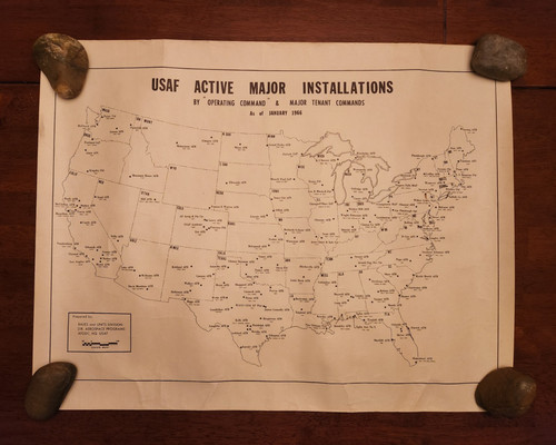
Vintage 1966 United States Air Force USAF Installation Base Map Command SAC TAC
Map shows locations of CONUS USAF installations. Installations are identified by Major Command abbreviations. Many of these installations do not exist anymore. United States Air Force USAF Installation/Base Map.

Vietnam-Era, QUANG TRI Annotated Field Map, 1967 Dated, Sheet 6442
Available is actual Vietnam-Era Annotated Field map for the QUANG TRI Provence, 1967 dated approx. The map has fold creases as can be seen but is still in very good condition, none of the creases are worn through, again, this was an actual field used map, not one that used in the safe confines of headquarters by staff.

Vietnam Conflict Map c.1968, Hammond
Great map of the Vietnam War
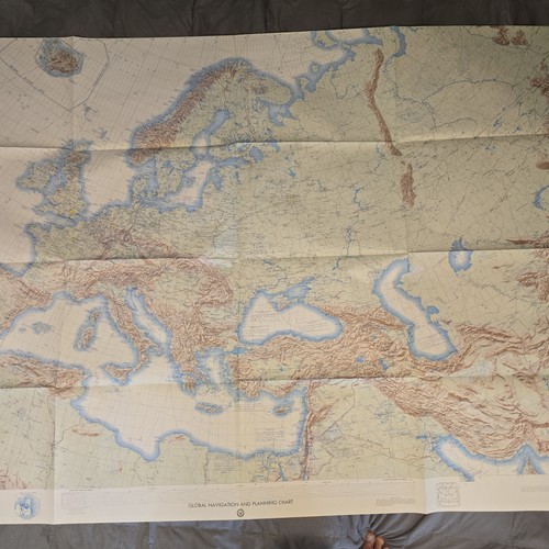
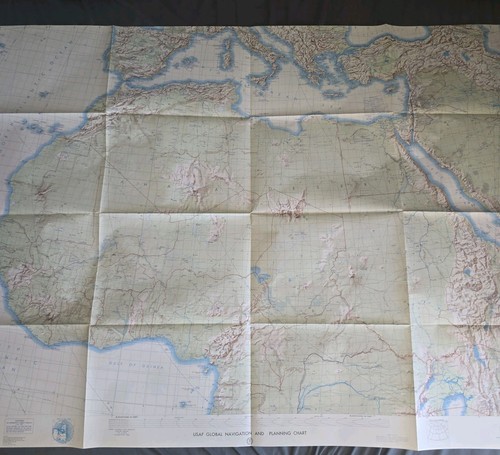
Global Navigation Planning Chart Map GNC-4N 1970 Europe DOD Air Force
Global Navigation and Planning Chart GNC-4N Lithograph 1970 1:5,000,000 57"x41" Ships folded Great pre owned condition
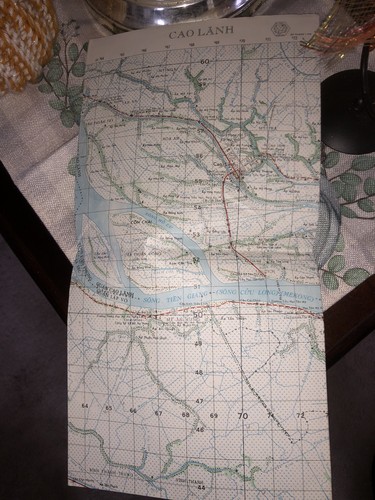
Vietnam Original Map - MACV-SOG - Det B-43 - CAO LANH - Mekong - Vietnam War
Vietnam Original Map - MACV-SOG - Det B-43 - CAO LANH - Mekong - Vietnam War Nice shape as shown

USAF Global Navigation Planning Chart Map French Polynesia GNC19N 1967 Air Force
USAF Global Navigation and Planning Chart French Polynesia GNC 19 N Lithograph 1967 1:5,000,000 57" x 41" Great pre owned condition Ships folded

Vietnam War US Military Rare Central Highlands Combat Map 1965
From a named grouping ! Please ask for additional photos if you need them or ask any questions about this item before you purchase. Items are sold "as described and photographed" and "as is". However, returns are accepted within 30 days of purchase for misdescription/wrong item. Please be aware that return shipping for refund will be at Buyer expense. A restocking fee may apply for any return/refund. Any return sent to us by the Buyer MUST be in the same state and condition as sent. We will exercise eBay's policies on returns, and any item returned damaged or otherwise in an improper condition will be subject to a 50% retention of Buyer purchase price. Thank you and have a great!

Jet Navigation Planning Chart Map JNC-45 1976 N Atlantic Ocean Air Force DOD
Jet Navigation Chart JNC 45 Lithograph 1976 1:2,000,000 57"X41" Great pre owned condition Ships folded

1991 Cambodia Topographic Map Tani Series L7015 US Army Edition 2-DMA 1:50,000
Title: TANI, Cambodia. This authentic U.S. Defense Mapping Agency (DMA) topographic map covers theTani region (Kampot Province) of Cambodia, produced at a1:50,000 scale. It’s part of the official DMA series used for military and geographic reference in Southeast Asia.

Vietnam Rare Ban Nham Confidential Map
My dad actually kept this in his safe.

Extremely Rare - SAIGON - CITY MAP - December 1970 - Gia Dinh - VIETNAM WAR
Printed - December 1970 - Gia Dinh / Saigon - Map shows suburb, district size and population as of 1969 with an overall population of 1,282,033. SAIGON City MAP. Rare - Vietnam War Map -. Printed December 1970.

Vintage Vietnam Conflict Map By CS Hammond- Index & Chronology Of Events

MAP OF 1967 VIETNAM + SURROUNDING AREAS, 18" x 12" Nice display size / Gift idea
Good quality and size for display. MAP OF 1967 SOUTH VIETNAM + SURROUNDING AREAS AS SHOWED IN PHOTOS, 18" x 12" Nice display size / Gift idea.
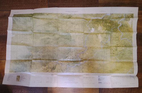
Vietnam War Map 1965 Combat Room Map Sheet 6640 IV N Series L8020
Map is clean, without fading, no tears. Beautiful condition.

Global Loran Navigation Chart GLC-8N 1968 Western USA Pacific Hawaii Air Force
Global Loran Navigation Chart GLC-8N Lithograph 1968 57"x41" Ships folded Great pre owned condition
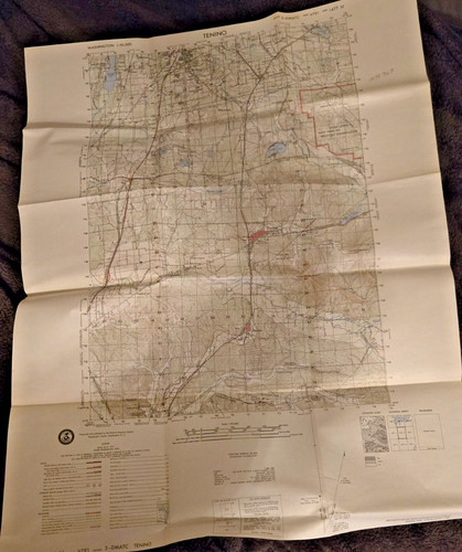
U.S. Military 1974 Tenino Washington Map By Defense Mapping Agency 1:50,000
The product is an original 1974 Tenino Washington map by the Defense Mapping Agency, featuring a 1:50,000 scale. This collectible item is linked to the Vietnam War, making it a valuable piece of militaria from the United States.

Vintage Vietnam Conflict Map By CS Hammond- Index & Chronology Of Events
In vintage condition with yellowing, tears etc especially by the creases. Measures about 21x29” unfolded.

Global Navigation Planning Chart Map GNC 20N 1965 Fiji Pacific Ocean Air Force
USAF Global Navigation and Planning Chart GNC 20N Lithograph 1965 1:5,000,000 57"X41" Good pre owned condition Ships folded

Vietnam War Maps Lot South Vietnam Military & SE Asia Newspaper 1960s
Lot of 2 vintage Vietnam War-era maps featuring South Vietnam and Southeast Asia. Includes: • South Vietnam military map with troop and regional details • Southeast Asia map showing surrounding countries and geopolitical context • Likely newspaper or publication inserts from the 1960s Details: • Original period items (Vietnam War era) • Paper maps, fold-out style • Educational / military reference material Condition: Pre-owned vintage condition with typical age wear. Includes fold lines, edge wear, and light discoloration. No major tears observed. Please review all photos for condition and details. Great collectible for Vietnam War history enthusiasts or display.
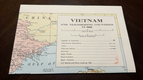
1968 VIETNAM and Neighboring Countries MAP war 7th LAOS CAMBODIA Hammond
19”x25” in Very Good condition From Hammond International Detailed map of 1968 Vietnam and surrounding countries with placement of 7th Fleet in waters surrounding.

1973 Cambodia Topographic Map Phum Phkoam Series L7015 Army 1:50,000 Vietnam War
Title: Phum Phkôâm, Cambodia. This original1:50,000 scale topographic map ofPhum Phkôâm, Cambodia was prepared and published by theDefense Mapping Agency Topographic Center (DMA) in1973, with map data compiled as of1971.

18" x 12" MAP OF 1965 VIETNAM and SURROUNDING AREAS, Good quality for display
Good quality and size for display. 18" x 12" MAP OF 1965 VIETNAM and SURROUNDING AREAS OF CAMBODIA, LAOS AND EASTERN THAILAND.
USAF Global Navigation Planning Chart Map GNC-11N 1968 North Africa Air Force
USAF Global Navigation and Planning Chart GNC 11N Lithograph 1968 1:5,000,000 57"X41" Great pre owned condition Ships folded

1960 USAF JET NAVIGATION CHART,.CASPIAN SEA & IRAN,JN-23,NICE CONDITION ORIGINAL
SEE PICTURES FOR ACTUAL CONDITION.

Vintage Vietnam Original Conflict Map by CS Hammond Co 1965 Great Condition
The product is a vintage original conflict map of Vietnam from 1965 by CS Hammond Co. This collectible item falls under the theme of militaria, specifically focusing on the Vietnam War period. The map provides a unique and historical perspective on the conflict, making it a valuable piece for collectors and enthusiasts interested in military history. Great condition!
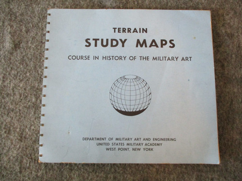
1960s TERRAIN STUDY MAPS VIETNAM ERA WEST POINT COURSE-HISTORY MILITARY ART BOOK
He was highly decorated for his service and retired as a Lieutenant Colonel.

1960s Saigon U.S. Army Engineering Map Service Vietnam War Era Large #L909 VTG
Large Saigon map dated 12-64 from the army map service. It's in worn, used condition with multiple flaws noticed. I could only find one other original that sold recently. Yellowing throughout. Multiple pen markings.

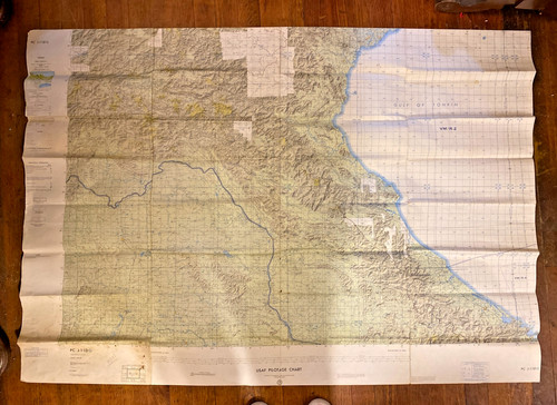
1969 U.S. Military JOG Air Map Las Vegas Nevada Arizona California 1:250,000
Original 1969 U.S. military Joint Operations Graphic Air map covering the Las Vegas, Nevada area, with portions of Nevada, Arizona, and California. This is sheet JOG (A) 1501 NJ 11-12, Edition 1, with a scale of 1:250,000.

USAF Global Navigation Planning Chart Map GNC-25N 1967 New Zealand Air Force DOD
USAF Global Navigation and Planning Chart GNC 25N Lithograph 1967 1:5,000,000 57"X41" Great pre owned condition Ships folded
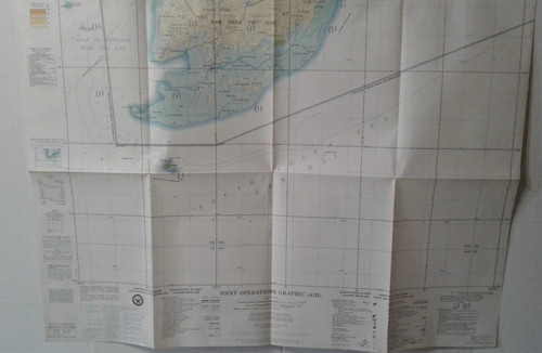
US Army Joint Operations Graphic Map CAI NUCO Vietnam War 1967
No writing. nice condition.
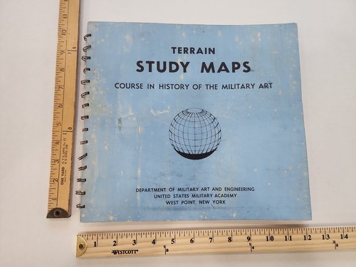
Vintage 1960s West Point Terrain Study Maps Textbook **Back Cover Loose
You save $5.00

Poland Special Map A 1:50000 Scale U.S. Army Infantry School Fort Benning 1967

Vietnam Conflict Map
The Vietnam Conflict Map is an original piece from the era of the Vietnam War (1961-75), making it a unique and valuable collectible item for enthusiasts of militaria. This map, created in Vietnam, offers a historical perspective on the conflict and is sure to be a prized addition to any collection focused on this period of time. Its authenticity and connection to the country where the conflict took place add to its significance and appeal to collectors interested in this specific period of history.

Vtg Map Air Force Missile Test Center Range 1963 Cape Canaveral
Some paper damage as shown
You save $5.00

1967 National Geographic Map Vietnam Cambodia Laos Thailand Southeast Asia
Original National Geographic Society wall map of Vietnam, Cambodia, Laos, and Thailand, published in February 1967 during a pivotal period in Southeast Asian history. Covers Vietnam, Cambodia, Laos, and Thailand.
You save $0.75
USAF PILOTAGE CHART Map Of Laos, Thailand, Vietnam, Gulf Tonkin ‘65 Vietnam War
The chart is in very good condition and has been well-preserved over the years, making it a fantastic addition to any collection. This is the real thing!