World
world — pre-owned
Browse 921 world — pre-owned on eBay — listings updated every few minutes. All items are pre-owned and sold by eBay sellers directly.

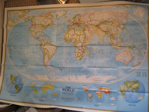
HUGE VINTAGE THE WORLD MAP + POLLUTION National Geographic December 1970
The World Map + How Man Pollutes His World December 1970 This huge two-sided poster is in very good condition with no marks or tears. Some folds have been taped for reinforcement. It is an original map that was in a National Geographic magazine. It is 29" x 42". 516 Terms: Powered by The free listing tool. List your items fast and easy and manage your active items. Powered by The free listing tool. List your items fast and easy and manage your active items. Powered by The free listing tool. List your items fast and easy and manage your active items. Powered by The free listing tool.

1941 National Geographic World Map Double Hemisphere Vintage WWII Era
Land and water hemisphere insets. Double hemisphere world layout. Published December 1941 by the National Geographic Society for The National Geographic Magazine. World mapping accuracy graphic.

Publix Armadillo Projection of the World Map Wall Hanging, Revised 1976
The Publix Armadillo Projection of the World Map Wall Hanging, Revised 1976 is a unique and collectible piece that showcases a detailed world map in a visually engaging way. The armadillo projection creates a three-dimensional effect, making it a standout piece for any space. With its historical revision in 1976, this wall hanging offers a glimpse into the past while also serving as a functional and decorative addition to any room. There are a few damage spots, specially by the corners, See pictures for more details please. Shipping Via FedEx Ground

Atwood Regional-Political Series Asia Map 1949 Printed USA Wall Chart
This is an Atwood Regional-Political Series map titled "Asia," published by A.J. Nystrom & Co., Chicago. It is a wall chart map printed on paper and mounted on cardboard backing, part of a comparative map studies series edited by Wallace W. Atwood, President of Clark University.

THE EARTH'S FRACTURED SURFACE EARTHQUAKE FAULTS MAP National Geographic 1995
The Earth's Fractured Surface Map + Living on the Edge - California Fault Lines Map Where Tectonic Plates Meet Seismology April 1995 This two-sided poster is in mint condition. It is an original map that was in a National Geographic magazine. It is 22" x 36". 916 Terms: Powered by The free listing tool. List your items fast and easy and manage your active items. Powered by The free listing tool. List your items fast and easy and manage your active items. Powered by The free listing tool. List your items fast and easy and manage your active items.

Vintage HAMOND Asia Lithographed Superior Wall Map 50"x33"

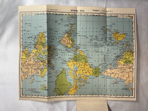
Vtg 1950's Cram's Modern Series Pocket Map of the World On Mercators Projection
Very good condition overall. Still in Original plastic sleeve. Cover may have slight edge and/or corner wear. If you find a number of things you are interested in.
You save $1.29

Large Vintage World Rainfall Folding Wall Map
Full color 42 x 36 inch linen-backed folding wall map pictorialy and graphically shows world annual rainfall amounts. Map folds neatlly into its attractive green faux leather covering, and has three brass grommets along the top for efficient hanging. Map was produced by George Philip & Son, and distributed by Dennoyer-Geppert c1930s-40s. Light age-tanning but in a well-preserved condition.
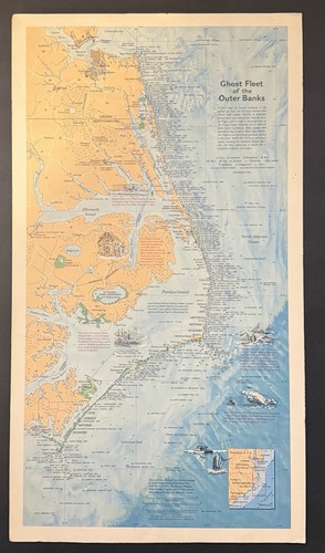
Vtg 1970 Ghost Fleet Of The Outer Banks - National Geographic Poster Board 11x20
Vintage 1970 “Ghost Fleet of the Outer Banks” Poster Board Approx 11” x 20” By National Geographic Society Edges / corners have some wear + back has 2 marks where poster was taken down —- See Photos

ARCTIC OCEAN FLOOR +ATLANTIC OCEAN FLOOR MAP National Geographic January 1990
Arctic Ocean Floor Map + Atlantic Ocean Floor Map Exploring and Mapping the Seafloor January 1990 This two-sided poster is in mint condition. It is an original map that was in a National Geographic magazine. It is 21" x 32". 116 Terms: Powered by The free listing tool. List your items fast and easy and manage your active items. Powered by The free listing tool. List your items fast and easy and manage your active items. Powered by The free listing tool. List your items fast and easy and manage your active items. Powered by The free listing tool.

Rand McNally World Portrait Map Wall Poster Full Color Large Format 52" x 34"
Nice Rand McNally Wall Map of the World including the polar ice caps. Folded but never hung.

WORLD WALL MAP + EARTH AT NIGHT National Geographic November 2004
World Map + Earth at Night November 2004 This two-sided poster is in very good condition with no marks or tears. It is an original map that was in a National Geographic magazine. It is 22" x 36". 118.

CHANGING CLIMATE +GREENHOUSE EARTH WALL MAP National Geographic October 2007
Changing Climate Wall Map + Greenhouse Earth Poster October 2007 This two-sided poster is in mint condition. It is an original map that was in a National Geographic magazine. It is 20" x 31". 116 Terms: Powered by The free listing tool. List your items fast and easy and manage your active items. Powered by The free listing tool. List your items fast and easy and manage your active items. Powered by The free listing tool. List your items fast and easy and manage your active items. Powered by The free listing tool. List your items fast and easy and manage your active items.

Original school charts map The world after World War I /1918 - large print 1962
The world after World War I /1918 - large print 1962.

1931 Literary Digest Atlas of the World & Gazetteer Randy McNally Pre-WWII Maps
1931 Literary Digest Atlas of the World and Gazetteer. Gazetteer / Index. Gazetteer index section present through the final pages. Title: Literary Digest Atlas of the World and Gazetteer. Atlases such as this were intended to help readers locate places discussed in international news during a period of rapid global change.
Vintage Mini World Map Booklet - Very Rare Collectable - Extremely Detailed Map
The detail is amazing on the map and it all folds up into a 3 x 5 little booklet. + Highly collectible. + Rare and very hard to find. + From my personal collection. + Vibrant colors.
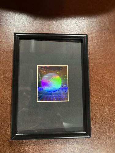
3D Earth with Grid Hologram Picture FRAMED, Collectible EMBOSSED Type Film
3D Halogram framed, & matted In excellent shape Glass with hard plastic frame with desk stand 1980’s era
THE WORLD POLITICAL & PHYSICAL MAP National Geographic February 1994
The World Political Map + The World Physical Map February 1994 This huge two-sided poster is in mint condition. It is an original map that was in a National Geographic magazine. It is 30" x 43". 416 Terms: Powered by The free listing tool. List your items fast and easy and manage your active items. Powered by The free listing tool. List your items fast and easy and manage your active items. Powered by The free listing tool. List your items fast and easy and manage your active items. Powered by The free listing tool. List your items fast and easy and manage your active items.
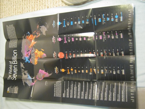
THE WORLD OF SEVEN BILLION MAP National Geographic March 2011
The World of Seven Billion Map March 2011 National Geographic This map is in mint condition. It is 20" x 31". It is a genuine map that was in a National Geographic magazine. 818.

Rand McNally Laminated 1993 World Map Atlas Placemat 2 sided kids puzzle games
The Rand McNally Laminated 1993 World Map Atlas Placemat is a 2-sided educational tool designed for kids as a puzzle game. With a world map view, this placemat provides a fun and interactive way for children to learn about geography and transportation. Perfect for encouraging curiosity and exploration, this collectible item from 1993 is sure to be a valuable addition to any child's education.
You save $12.00

Political Map of South America C.S. Hammond & Co, NY Map colorful vintage 5x7in
You save $2.35

THE WORLD + THE WORLD SATELLITE MAP National Geographic August 2004
The World Map + The World Satellite Map August 2004 This two-sided poster is in mint condition with no marks or tears. It is an original map that was in a National Geographic magazine. It is 20" x 32". 517 Terms: Powered by The free listing tool. List your items fast and easy and manage your active items. Powered by The free listing tool. List your items fast and easy and manage your active items. Powered by The free listing tool. List your items fast and easy and manage your active items. Powered by The free listing tool. List your items fast and easy and manage your active items.

VINTAGE LANDS OF THE EASTERN MEDITERRANEAN MAP National Geographic January 1959
Lands of the Eastern Mediterranean Map January 1959 This poster is in mint condition with no marks or tears. It is an original map that was in a National Geographic magazine. It is 19" x 25". 416 Terms: Powered by The free listing tool. List your items fast and easy and manage your active items. Powered by The free listing tool. List your items fast and easy and manage your active items. Powered by The free listing tool. List your items fast and easy and manage your active items. Powered by The free listing tool. List your items fast and easy and manage your active items.

National Geographic map~1999 August~Cultures~languages~Millennium in maps~poster
Included with issue: 1999 August.

VINTAGE TOP OF THE WORLD ARCTIC MAP National Geographic November 1965
Top of the World Map November 1965 This one-sided poster is in very good condition with no marks or tears. It is an original map that was in a National Geographic magazine. It is 19" x 25". 324.

2 REPRODUCTIONS OF OLD MAPS, HEMISPHERES OF HEAVENS & EARTH & 1651 VIEW OF EARTH
See Photos above for map details. Will also include a Mounting Instruction Sheet.

Hammond's International Vintage Old Large Weekly Reader World Wall Map + Africa
Map has light use wear and tear and aging. 38" x 26". Let's treat each other with respect and discuss any problems.

The CBS Map of the Changing World, FirstEdition as of January, 1948
First Edition as of January, 1948. Complete and in good used condition has 4 small pin holes in the folds.

Atwood Regional-Political South America Map 1949 Edition Wall Chart
The map is arranged for comparative map studies and edited by Wallace W. Atwood, President of Clark University. Size approx. 65" x 43" unfolded. The map is printed on a fabric or canvas-like material and includes reinforced holes for hanging.

Children’s Illustrated Map of the World Poster - Kids World Map
Children’s Illustrated Map of the World Poster - Kids World Map
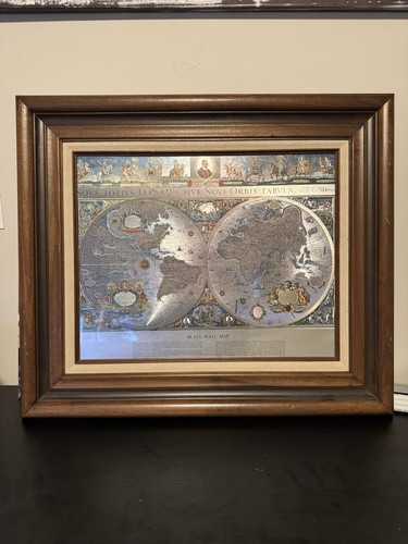
OriginalWorld Map Silver Leaf Print Based on Original Willem Blaeu Map 1571-1638
The map shown is titled "Nova Totius Terrarum Sive Novi Orbis Tabula," which translates to "A new map of the whole world" or "A new view of the entire world." It is a world map created by cartographer Willem Blaeu, dating back to the early 17th century. This is a beautiful silver leaf map in a well made vintage frame that would make a wonderful addition to any room.

2003 Cavallini Stanford’s General Map of the World 27x21 Framed Vintage
• Distributed by Cavallini & Co. • © 2003 Stanfords, London, England. • Good overall condition. Back marked.

1965 Island Workshop West Indies Caribbean Sea Pictorial Map 17” X 22 “Vintage
Printed on textured off-white stock with color accents in red, gold, and blue. There is a small foxing spot in the lower left quadrant near Jamaica and a light crease in the bottom margin outside the printed border. Overall the map presents very well and would frame beautifully. Island Workshop produced a small series of Caribbean pictorial maps in the mid-1960s that have become sought-after pieces among vintage map and travel ephemera collectors.

1960s Moon Map & World Political Map Cold War Space Race Rand McNally WMT Radio
In two spots, there is tape adhesive residue which was likely from when it original was sent and taped closed. 4" x 9" when folded and approx. 19.5" x 26.5" when unfolded - light gloss coating and standard map paper material.

National Geographic Map The World Political February 1994
This is an original February 1994 National Geographic Society supplement map, “The World,” featuring polar azimuthal projections of the Arctic region alongside detailed Pacific Ocean current and wind pattern mapping. A great find for cartography collectors, geography teachers, or vintage map enthusiasts. Wonderful gift for travelers, students, or anyone who loves world maps. vintage map, national geographic, world map, 1994 map, arctic ocean map, pacific ocean map, ancient cartography, wall decor, geography gift, teacher gift, paper ephemera, vintage collectible

Vintage Map-Ghost Fleet Of The Outer Banks-1970 National Geographic 25” X 15”
Frame and map in very good condition. See Photos for details. Any questions please ask.
You save $13.30

Doctor’s Without Borders Map
This map serves as a visual representation of the organization's global reach and impact, making it a valuable tool for supporters and donors looking to understand the scope of their work.
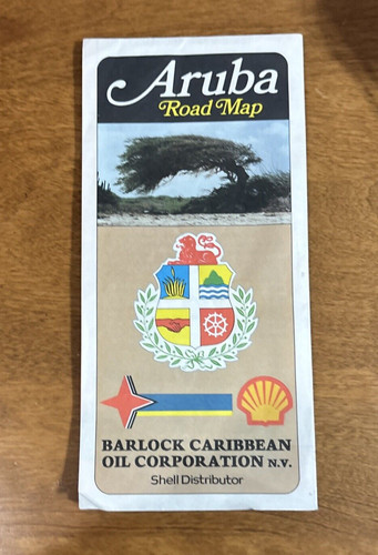
Vintage Aruba Road Map Shell Distributer Barlock Caribbean Oil Corp N.V. A-9213
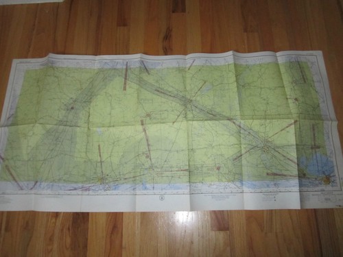
1957 BEAUMONT SECTIONAL CHART MAP - 49" X 33" - TUB RH-3
You save $49.99
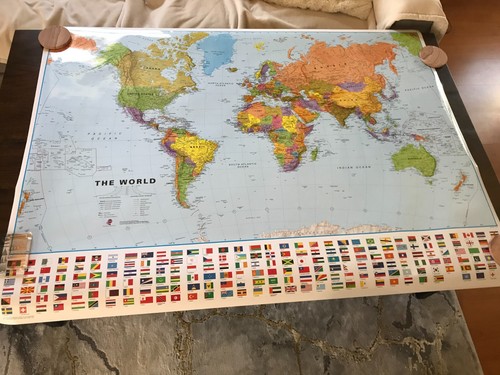
Large Laminated World Map 39" Tall x 53" Wide Geography Education International
Large Laminated World Map 39" Tall x 53" Wide. National Geographic. Excellent Condition. Great Education Tool for Learning Geography. Craenen International Map Distributor.